Farmer Follow-Up App
User: Beneficiary Farmers
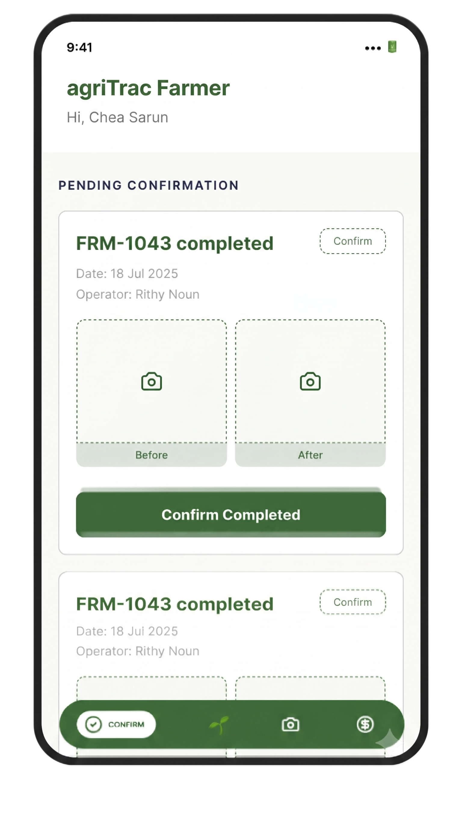
- Conduct follow-up assessments
- Collect beneficiary feedback
- Track changes over time
- Measure satisfaction and experience
- Capture qualitative and quantitative evidence
From field event to funder evidence
A monitoring, measurement, and reporting platform designed for implementing agencies to track how funds are translated into activities, results, and impact.
We give implementers full visibility into the field – so every project is monitored & every result verified
Precise GPS coordinates, spatial boundaries, and location-bound field evidence.
Time-stamped logs, execution timestamps, and audit-ready temporal tracking.
Verified inputs, photo proof, service delivery records, and beneficiary counts.
Verify that planned activities are actually being delivered with location-based evidence
User: Service Provider
Capture implementation evidence directly from the field:
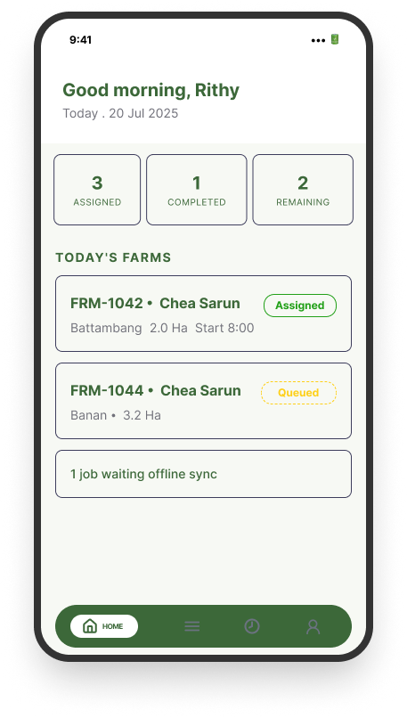
Overview of tasks & activities
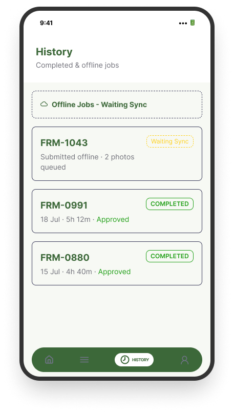
Log service delivery & operations
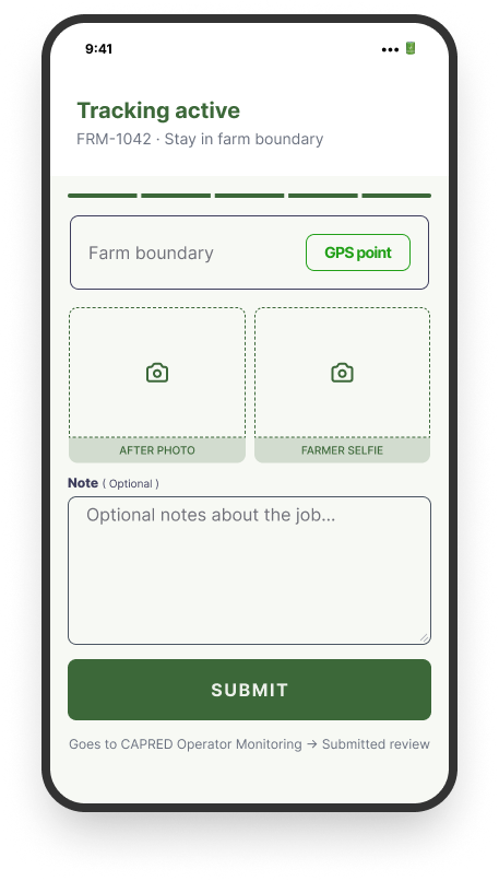
Location tracking & geofencing
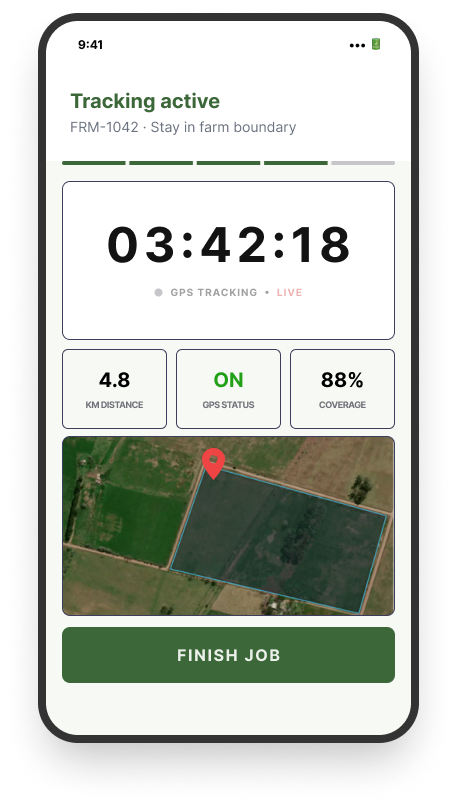
Time-stamped photo evidence
Understand what happened to beneficiaries and whether results are being achieved
User: Beneficiary Farmers
User: Implementer
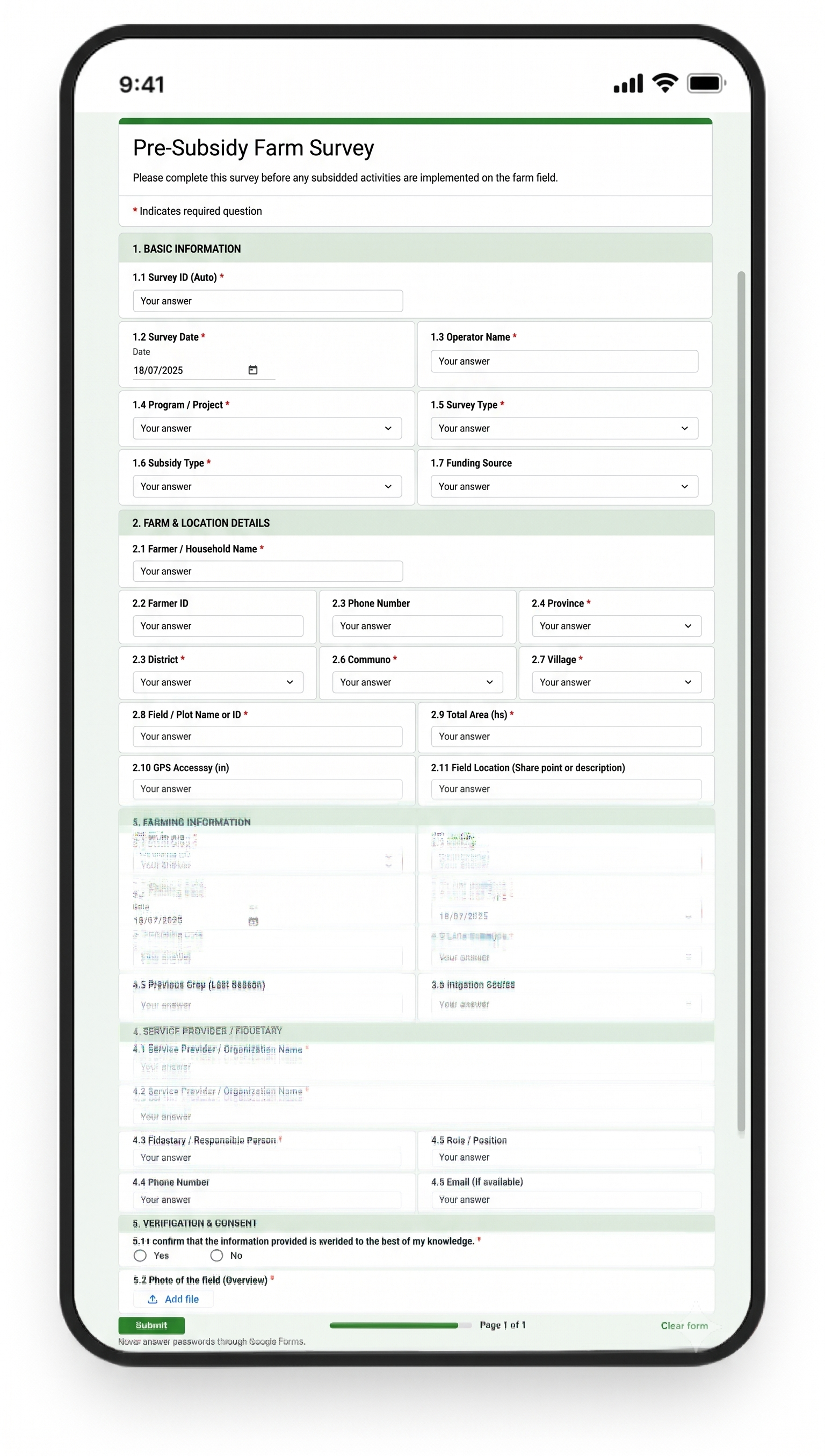
User: Implementer
Purpose: Combine field evidence, beneficiary data, survey results, and independent verification to understand whether activities are producing measurable results.
Centralised view of project performance with a clear, evidence-backed audit trail
User: MEL Team
Bring project information together in one management environment:
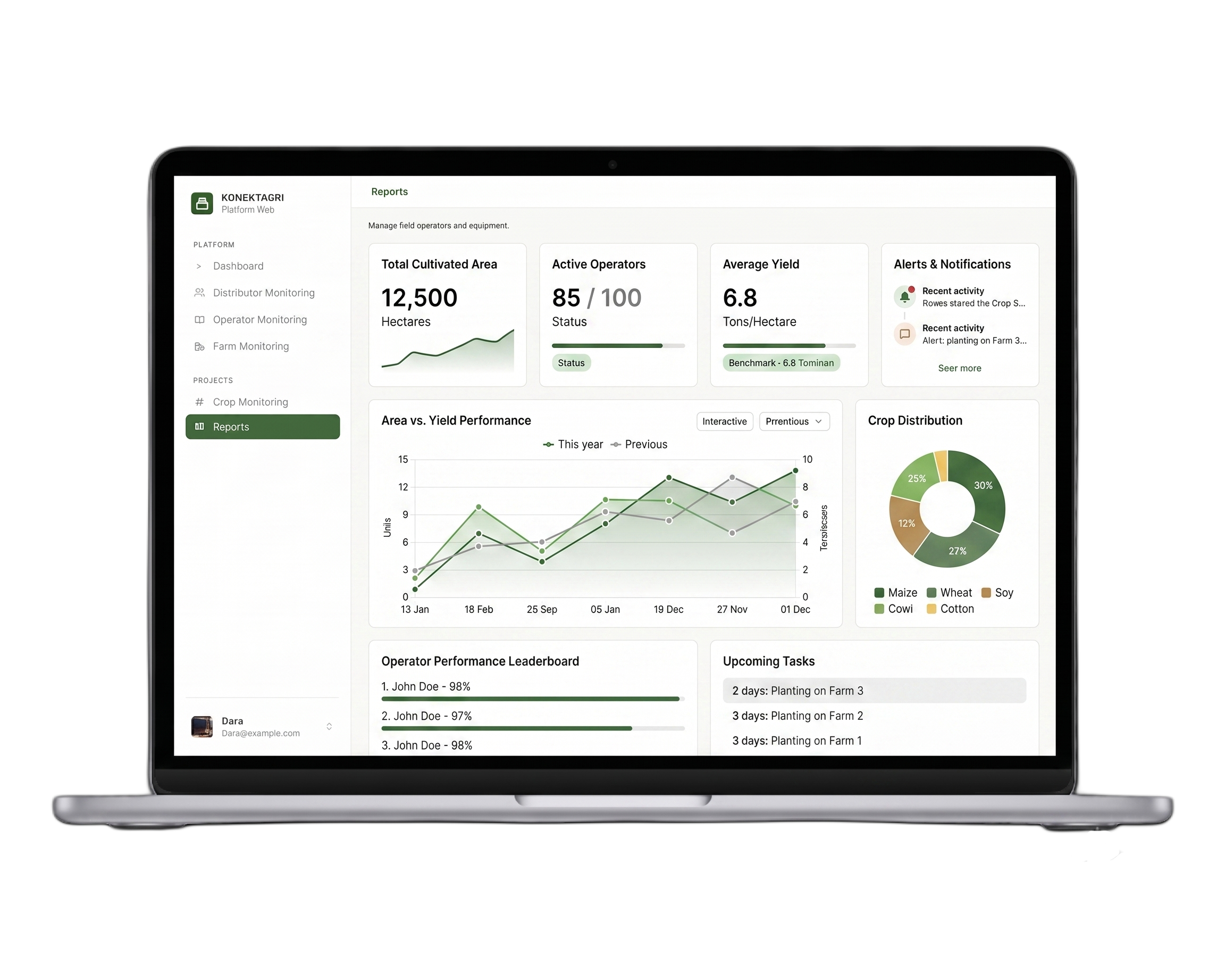
Purpose: Give MEL and management teams a clear, evidence-backed view of project performance.
agriTrac™ connects five modules across the implementation and measurement cycle
Capture what happened in the field
Capture what beneficiary feed back & evaluate changes
Collect structured baseline, comparison, and outcome data
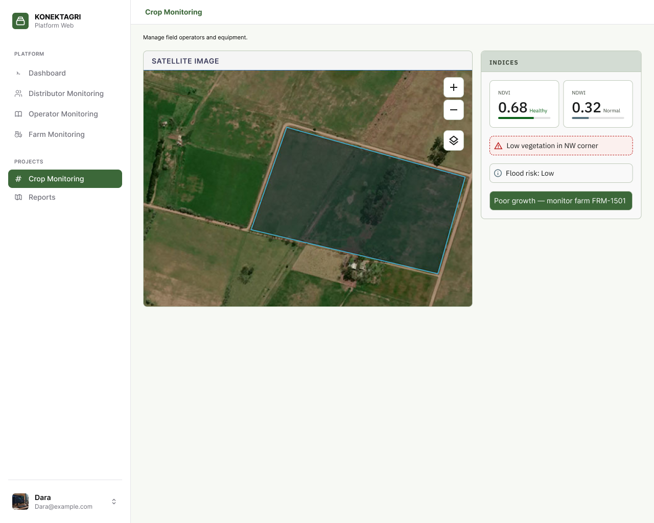
Independently verify and analyze activities using satellite
Bring evidence together for monitoring, management, and reporting
Follow the implementation journey from funded activity to measurable result
Connect activities with GPS, photographs, timestamps, and supporting records
Use satellite evidence as an additional layer of verification
Give programme and MERL teams a clear view of implementation progress and potential issues
Keep activities, results, and supporting evidence connected for transparent reporting and review
Service Providers
Record and verify implementation
Beneficiary Farmers
Provide feedback and follow-up information
Enumerators
Collect structured survey and assessment data
Analytics Teams
Analyze efficacy of interventions
MERL Teams
Monitor indicators, evidence, results, and reporting
Programme Management
Gain visibility across implementation, performance, and accountability